Algeria
 Egypt
 Libya
 Morocco
 Sudan
 Tunisia
 Benin
 Burkina Faso
 Cabo Verde
 Côte d'Ivoire
 Ghana
 Guinea
 Guinea-Bissau
 Liberia
 Mali
 Mauritania
 Niger
 Nigeria
 Sierra Leone
 The Gambia
 Togo
 Cameroon
 Central African Republic
 Chad
 DR Congo
 Equatorial Guinea
 Gabon
 Republic of the Congo
 São Tomé and Príncipe
 Burundi
 Comoros
 Djibouti
 Eritrea
 Ethiopia
 Kenya
 Madagascar
 Malawi
 Mauritius
 Mozambique
 Rwanda
 Seychelles
 Somalia
 South Sudan
 Tanzania
 Uganda
 Angola
 Botswana
 Eswatini
 Lesotho
 Namibia
 South Africa
 Zambia
 Zimbabwe
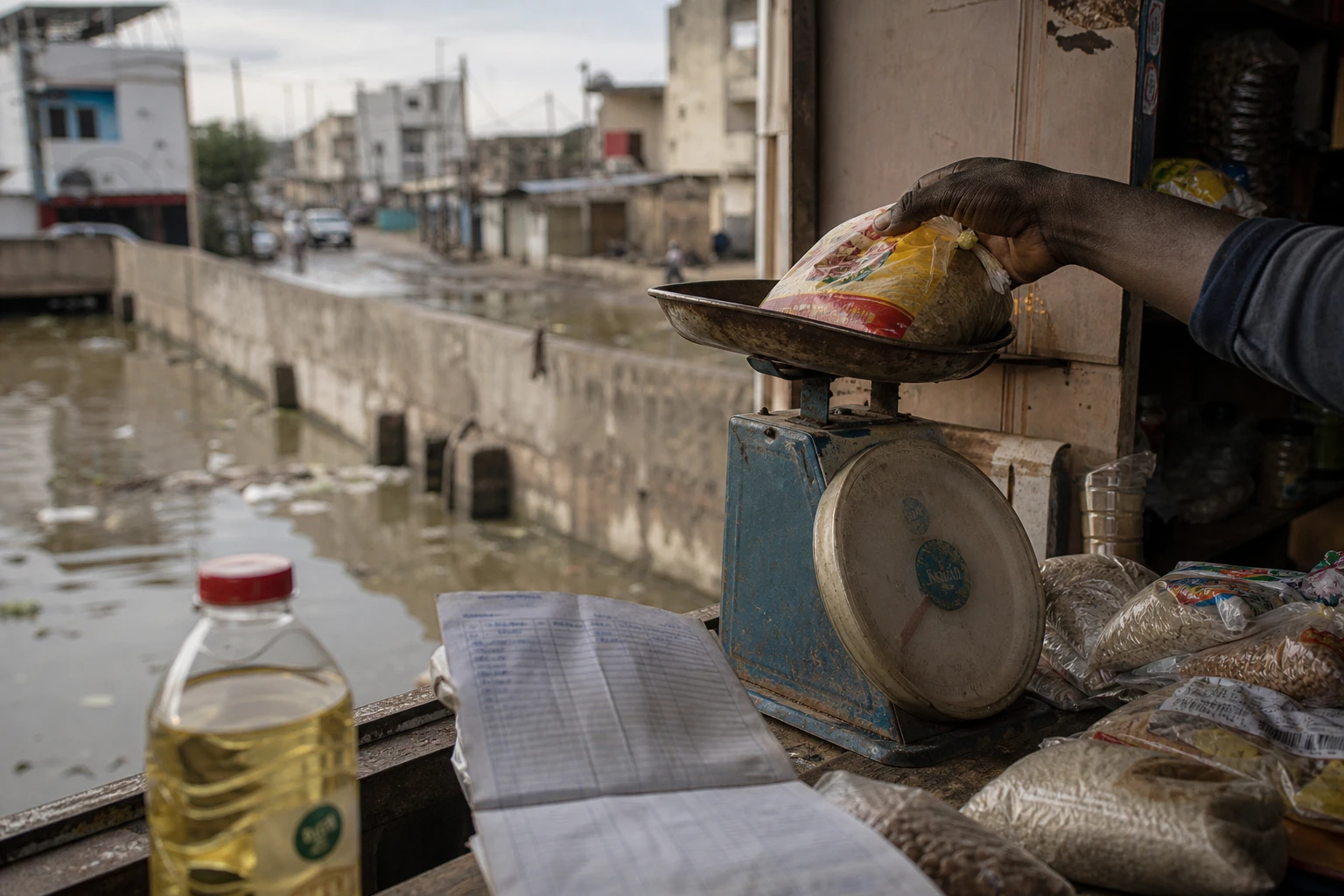
In Guédiawaye, the rain did more than fill the streets. It brought a more difficult question back to the fore: what is a protective structure worth when it reaches its limit just as neighbourhoods need it most? After the rainfall on 4 and 5 October 2026, retention basins in Dakar’s suburbs once again came under heavy pressure.
Exceptional rainfall in the Dakar metropolitan area
During the night of Sunday 4 to Monday 5 October, several parts of the Dakar region received large volumes of water within a few hours. Available readings recorded 142 millimetres in Rufisque, 138 millimetres in Dakar-Yoff and more than 100 millimetres at several other stations.
In Guédiawaye, figures vary between measuring stations. Readings cited by technical services put rainfall at 97 millimetres, while other data give 107 millimetres. The variation reflects the highly uneven distribution of rain across the urban area. It does not, however, alter the overall picture: the drainage networks and basins were placed under considerable strain.
The National Agency for Civil Aviation and Meteorology, ANACIM, also described the episode as one of the most intense recorded recently in the capital. At Dakar-Yoff, rainfall reportedly reached about 137.5 millimetres over 24 hours, making that day one of the wettest observed since 1981. Readings published after the rainfall confirm the scale of the event.
Basins built after the major floods
Retention basins are among the structures built to reduce the exposure of Dakar’s suburbs to flooding. Their purpose is straightforward: to temporarily collect surface runoff, slow its progress and then release it gradually through drainage networks and pumping stations.
This policy gained momentum after the major floods of the late 2000s and early 2010s. Guédiawaye, Pikine, Keur Massar and several other parts of the metropolitan area suffered extensive damage. The Ten-Year Flood Management Programme was launched to strengthen infrastructure, improve water drainage and reduce the vulnerability of neighbourhoods in low-lying areas.
The problems observed on 4 and 5 October do not necessarily mean that all the structures are useless. Rather, they show the limits of a system required to handle highly concentrated rainfall in a densely built-up city where natural drainage areas have shrunk considerably.
Hydraulic capacity at the heart of questions in Guédiawaye
Several factors can combine when basins overflow. The first is the volume of rain falling in a short time. The second is the actual storage capacity. A basin filled with sediment, overgrown vegetation or waste loses some of its usable volume.
Desilting involves removing mud and deposits accumulated at the bottom. Basin profiling, in turn, helps maintain sufficient capacity to accommodate rainwater. These operations must be carried out regularly, especially before the rainy season. Their effectiveness also depends on the functioning of channels, pipes and downstream pumping equipment.
At the end of September 2026, the National Sanitation Office of Senegal, ONAS, announced a clearance operation at two basins in Gounass, in the department of Guédiawaye. The intervention shows that infrastructure maintenance remains a practical concern. It does not, on its own, establish the precise condition of every basin affected by the October rains.
Available public information does not yet make it possible to determine whether the overflows were caused mainly by poor maintenance, insufficient capacity, blockages in the networks or a combination of these factors. A detailed hydraulic assessment will have to establish the relative contribution of each cause.
Residents bear the immediate cost of overflows
In surrounding neighbourhoods, flooding brings very tangible losses. Water can enter homes, damage electrical installations and make entire rooms unusable. For small businesses, just a few hours under water can be enough to damage goods, equipment and stocks bought on credit.
The consequences are not the same for everyone. Households with savings or homes on higher ground can move their belongings to safety more quickly. Families living in the lowest-lying areas, tenants and street vendors have far less room to manoeuvre.
The episode also disrupted travel in several parts of Dakar and its suburbs. Roads were slowed or cut off, while emergency and pumping teams worked at the worst-affected locations. The authorities activated the regional emergency response and mobilised the relevant services.
A provisional toll released after the rainfall reported several deaths nationwide, including a mother and her child at Parcelles Assainies. The precise circumstances must, however, be distinguished by location and verified by the authorities responsible for the investigation. The first available information on casualties and disruption remains provisional.
PROGEP 2 put to the test on the ground
Guédiawaye is among the areas covered by the Stormwater Management and Climate Change Adaptation Project, known by its French acronym, PROGEP 2. The programme, scheduled to run from 2021 to 2029, mobilises about 170 billion CFA francs, with funding from the Government of Senegal, the World Bank, the African Development Bank and the Nordic Development Fund.
The project covers Guédiawaye, Pikine, Keur Massar, Rufisque, Thiès, Mbour and Saint-Louis, among other areas. It includes drainage networks, storage structures and alert systems. According to a progress report presented in 2025, about 46,000 linear metres of primary and secondary networks had been built.
These investments reduce some risks, but they do not replace routine maintenance. A structure’s performance depends on its design, its connection to the rest of the network, the availability of pumps and the monitoring of the sites. It also depends on preventing rubbish from accumulating in channels and basins.
Senegalese authorities have announced an integrated national strategy for flood-risk management. This approach will need to clarify responsibilities between the state, ONAS, local authorities and local committees. It will also need to make budgets for desilting, pumping and maintenance more transparent.
An issue extending beyond Dakar’s suburbs
The situation in Guédiawaye is part of a wider regional problem. In the major cities of the Economic Community of West African States, urban growth often outpaces sanitation networks. The paving over of land increases runoff, while settlement in low-lying areas reduces the space available to hold water.
For Senegal, the next step will be to check water levels in the basins, the condition of the networks and pumping capacity before further rain. ANACIM is maintaining a watch over several parts of the country. The end of the rainy season therefore does not mean the risk will disappear immediately.
The October 2026 episode ultimately raises a question about continuity in public action. Building a basin is a first response. Preserving it, regularly measuring its capacity and reporting on its maintenance are the conditions that allow the investment to genuinely protect residents.