Algeria
 Egypt
 Libya
 Morocco
 Sudan
 Tunisia
 Benin
 Burkina Faso
 Cabo Verde
 Côte d'Ivoire
 Ghana
 Guinea
 Guinea-Bissau
 Liberia
 Mali
 Mauritania
 Niger
 Nigeria
 Senegal
 Sierra Leone
 The Gambia
 Togo
 Cameroon
 Central African Republic
 Chad
 DR Congo
 Equatorial Guinea
 Gabon
 Republic of the Congo
 São Tomé and Príncipe
 Burundi
 Comoros
 Djibouti
 Eritrea
 Ethiopia
 Kenya
 Malawi
 Mauritius
 Mozambique
 Rwanda
 Seychelles
 Somalia
 South Sudan
 Tanzania
 Uganda
 Angola
 Botswana
 Eswatini
 Lesotho
 Namibia
 South Africa
 Zambia
 Zimbabwe
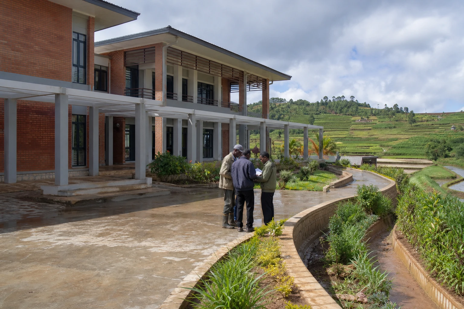
In Itasy, the soil does not disappear all at once. It is carried away in thin layers by rain, flowing towards rice fields, low-lying land and the lake. For farming families, this erosion turns an environmental problem into lost harvests, income and, at times, cultivable land.
A pressured watershed near Antananarivo
The Itasy region lies in Madagascar’s central highlands, west of Antananarivo. Its economy relies heavily on agriculture, particularly rice, beans, potatoes, fruit and market gardening. Fishing and handicrafts also depend on the lakes and wetlands.
In this landscape of hills and valleys, water flows rapidly when heavy rains arrive. Cultivated slopes then lose some of their arable land. This topsoil contains most of the organic matter and nutrients plants need. Once it is washed away, productivity falls and the soil becomes harder to work.
The phenomenon cannot be explained by a single cause. Slope, soil type, rainfall, declining vegetation cover, fires, land clearing and certain farming practices can all combine. Scientific studies nevertheless point out that the origins and development of lavaka—deep gullies characteristic of Madagascar’s highlands—are more complex than a simple consequence of human activity.
Madagascar’s report on the state of the environment describes the importance of sediment from gullies and sheet erosion in the Itasy watersheds. It also highlights the effects of downstream silting.
Fields covered in sand
The effects are first seen in fields lower down the slopes. Material washed away from hillsides accumulates in rice fields and fertile land. A plot can remain unproductive for several seasons, even when seeds and labour are available.
In Itasy, farmers say they have lost much of their land beneath deposits of sand. Rice, bean and potato crops are particularly exposed when canals and small water-management structures can no longer carry away sediment.
This situation directly affects incomes. The households concerned may have to buy more food, find additional work or cut agricultural spending. The impact varies from place to place. Farms near gullies and low-lying areas are most vulnerable, while families with commercial activities or non-farm income may be better able to absorb the shock.
Rural infrastructure is also damaged. Sediment can clog canals, damage tracks and reduce the effectiveness of irrigation works. Transport difficulties then make it harder to get harvests to market, particularly during the rainy season.
Planting and slowing water before it reaches the rice fields
In response to this degradation, farmers’ organisations, associations and NGOs are introducing combined solutions. These involve more than simply planting trees. The aim is to gradually retain water, keep the soil covered and slow the runoff.
The Agriter programme has notably supported the establishment of nurseries in the region. The seedlings produced include acacias, pines and robusta coffee. According to information provided under the programme, 26 nurseries have been set up and more than 1.5 million trees planted.
Agroforestry initiatives in Itasy combine hillside restoration, support for farmers and land-use planning. This approach aims to strengthen soil protection while maintaining an economic activity for households.
On steep land, farmers are also creating contour strips. These follow the natural shape of the hillside. They slow the water and help it soak into the ground. Plants that stabilise the soil, such as vetiver, lemongrass or certain forage species, can be planted along these lines. Food crops grow between the protected strips.
Over time, these measures can bring slopes closer to a system of agricultural terraces. Their effectiveness, however, depends on maintenance, continuity of work and farmers’ commitment. A single planting is not enough if gullies continue to widen upstream.
Lake Itasy, an agricultural and economic concern
Soil protection is therefore not limited to fields. Lake Itasy receives some of the sediment carried down from the hills. Silting can reduce the depth of the water, alter fishing areas and threaten activities around the lake.
Fishing, handicrafts and local visitor attractions all depend on this balance. The lake draws visitors, particularly from Antananarivo and other parts of the highlands. The gradual degradation of the lake would therefore affect several sectors beyond agriculture.
An assessment of the Lake Itasy watershed identifies several problems linked to erosion, declining soil fertility, the silting of rice fields and changes to the lake’s morphology.
A response that must go beyond tree planting
In Itasy, tackling erosion requires work across the watershed. Decisions made on the hills directly affect the fields and wetlands below. Farmers, municipalities, water managers and environmental protection groups must therefore co-ordinate their efforts.
This approach must also take economic realities into account. Households cannot always leave a plot fallow or devote time to maintaining a hedge without seeing a short-term benefit. Seedlings must suit the climate and local uses. Proposed solutions must protect the soil without reducing the land available for crops.
The issue also extends beyond Itasy. Madagascar is a member of the Southern African Development Community, SADC, which works on natural resource management, agriculture and climate adaptation. Across the Indian Ocean region and the continent, Madagascar’s experience underscores a shared reality: food security also depends on the ability to protect soils, watersheds and wetlands.
In the coming years, the challenge will be to measure the results of planting, monitor changes in the gullies and maintain the structures after projects end. For people in Itasy, protecting the land upstream means defending harvests, the lake and the local economy downstream.