Algeria
 Egypt
 Libya
 Morocco
 Sudan
 Tunisia
 Benin
 Burkina Faso
 Cabo Verde
 Côte d'Ivoire
 Ghana
 Guinea
 Guinea-Bissau
 Liberia
 Mali
 Mauritania
 Niger
 Nigeria
 Senegal
 Sierra Leone
 The Gambia
 Togo
 Cameroon
 Central African Republic
 Chad
 DR Congo
 Equatorial Guinea
 Gabon
 Republic of the Congo
 São Tomé and Príncipe
 Burundi
 Comoros
 Djibouti
 Eritrea
 Ethiopia
 Kenya
 Madagascar
 Malawi
 Mauritius
 Mozambique
 Rwanda
 Seychelles
 Somalia
 South Sudan
 Uganda
 Angola
 Botswana
 Eswatini
 Lesotho
 Namibia
 South Africa
 Zambia
 Zimbabwe
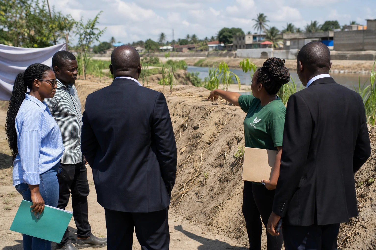
In Kipawa, in eastern Dar es Salaam, the Msimbazi River is more than just a waterway. It marks the boundary between homes, daily activities and a risk residents have long known: rapidly rising waters. As the October-to-December 2026 rainy season approaches, the neighbourhood is relying first on its own resources.
In Kipawa, taking action before the water rises
In the Karakata area, residents are reinforcing the riverbanks with sand, reeds, trees and locally available materials. Their aim is twofold: to slow erosion and guide water towards the Msimbazi’s main channel.
This work is no substitute for comprehensive water management infrastructure. It nonetheless demonstrates the organisational capacity of an exposed community that knows where water first overflows and where the ground gives way fastest. Tanzania’s English-language daily has documented these nature-based solutions in the Msimbazi basin.
In the neighbourhood, some residents have also built a sand embankment in a short time. Planting is intended to help hold the soil in place and limit the collapse of the riverbanks. This approach remains vulnerable to a major flood, but it offers an initial safeguard where permanent structures have been slow to arrive.
The risk is as personal as it is collective. Some families have already lost their homes in previous floods. For them, urbanisation has changed the river’s character. Natural areas that absorbed some of the water have shrunk, while buildings have moved closer to low-lying areas.
A growing city facing vulnerable geography
Dar es Salaam is home to a large share of Tanzania’s economic activity. The city attracts residents, businesses and services. This growth supports the metropolis, but it also increases pressure on available land, drainage networks and waterways.
The Msimbazi basin runs through several densely populated areas. When rainfall intensifies, water runs off built-up surfaces quickly. Waste can block drains. Land reclamation and construction sometimes reduce natural waterways.
The problem is therefore not limited to the amount of rain. It also has to do with land use, infrastructure maintenance and coordination between local authorities, water services and residents. In this context, community solutions can reduce some of the damage, but prevention cannot be their responsibility alone.
Tanzanian authorities have urged people living in exposed areas to consider moving temporarily or permanently. On the ground, this recommendation runs up against a simple question: where would they go? For households living near their work, a school or a family network, leaving the neighbourhood can mean losing income and a sense of belonging.
El Niño raises vigilance for the 2026 season
The Tanzania Meteorological Authority, the national weather agency, announced in August 2026 that the October-to-December Vuli rainy season would be influenced by what it described as a strong El Niño event. El Niño refers to the periodic warming of surface waters in the equatorial Pacific, which can alter rainfall patterns in several regions around the world.
The regional centre ICPAC, which coordinates climate information for the Horn of Africa and neighbouring countries, also forecasts wetter-than-normal conditions across part of the region between October and December 2026. Its bulletin highlights a risk of heavy rainfall in western Tanzania.
These forecasts cannot determine in advance the exact date, intensity or location of each flood. Instead, they help public services, local authorities and communities prepare. In Dar es Salaam, the challenge is to turn this information into clear alerts, evacuation routes and rapid responses.
Dar es Salaam’s water utility has also inspected several infrastructure sites ahead of the forecast heavy rains. It is monitoring, in particular, facilities exposed to overflows and sanitation networks. This institutional preparation will need to be assessed on the ground, neighbourhood by neighbourhood, because Kipawa’s needs may differ from those of areas farther from the Msimbazi.
A response that goes beyond the Msimbazi’s riverbanks
Flooding in Dar es Salaam is part of a wider challenge for East Africa. Tanzania belongs to the East African Community, or EAC, a regional bloc that facilitates cooperation between neighbouring countries. Climate alerts, hydrological data and response mechanisms stand to benefit from being shared across borders.
Episodes of intense rainfall affect several sectors at once. They can disrupt transport, undermine markets, damage homes and interrupt water supplies. Households working in the informal economy are particularly exposed when roads, stalls or storage areas become inaccessible.
In neighbourhoods near the river, prevention must therefore involve several levels. Residents contribute their knowledge of the area. Local authorities organise alerts and evacuations. Technical services maintain channels and secure infrastructure. Finally, the state must place these efforts within a sustainable strategy for managing the Msimbazi basin.
In Kipawa, planted trees and sand embankments reflect a determination to act before disaster strikes. They also highlight the limits of improvised responses. The next test will be whether weather alerts, public inspections and local initiatives can work together before the most intense rainy spells expected at the end of 2026.