Algeria
 Egypt
 Libya
 Morocco
 Sudan
 Tunisia
 Benin
 Burkina Faso
 Cabo Verde
 Côte d'Ivoire
 Ghana
 Guinea
 Guinea-Bissau
 Liberia
 Mali
 Mauritania
 Niger
 Nigeria
 Senegal
 Sierra Leone
 The Gambia
 Togo
 Cameroon
 Central African Republic
 Chad
 DR Congo
 Equatorial Guinea
 Gabon
 Republic of the Congo
 São Tomé and Príncipe
 Burundi
 Comoros
 Djibouti
 Eritrea
 Ethiopia
 Kenya
 Madagascar
 Malawi
 Mauritius
 Mozambique
 Rwanda
 Seychelles
 Somalia
 South Sudan
 Uganda
 Angola
 Botswana
 Eswatini
 Lesotho
 Namibia
 South Africa
 Zambia
 Zimbabwe
When ten centimetres of grass become useful data
In northern Tanzania, a grassland is no longer assessed by the naked eye alone. It is measured, photographed and compared from one month to the next. For Maasai herders, this makes a real difference: it helps them decide where to graze livestock, where to let the land rest and how to prevent a pasture from being exhausted before the next season.
This is no small matter in a country where the semi-arid areas of the centre and north-east, including the Maasai steppe, are exposed to land degradation. Tanzania’s rangeland guidelines note that agricultural pressure, fires, human settlements and overgrazing are weighing on these areas, while the national land degradation neutrality programme has identified several hotspots, including Dodoma, Singida, Tabora, Shinyanga and Manyara.
In northern Tanzania, monitoring returns to the village
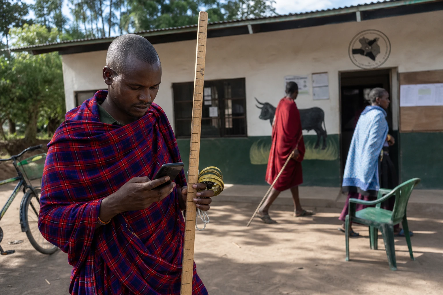
In Arkaria, pasture monitoring is carried out by residents trained to observe the same plots at regular intervals. A mobile app, a graduated stick, a tape measure and a photograph taken from the same direction are enough to produce a monthly record. The aim is simple: to turn traditional knowledge of the land into information the community can use.
Mesia Mepukori, one of the community monitors, measures the height of the grass, notes the colour of the vegetation cover and records the pasture’s status on his phone. The data is then sent to a conservation centre in the heart of the village, equipped with internet access and a display screen. This short chain prevents the information from remaining informal observation. It also gives greater weight to the decisions of the village grazing committee.
The initiative is led by African People & Wildlife, an organisation that received the IUCN’s 2025 Tech4Nature award in the NatureTech Stewards category for its work in Tanzania. The IUCN says the project combines geospatial tools, Indigenous knowledge and community management to support productive pastures across several dozen villages in the north of the country. The organisation also says the method is designed to be replicable.
Why the approach resonates in Tanzania today
The issue extends well beyond the village of Arkaria. In Tanzania, rangelands support pastoral livestock farming, wildlife and part of the rural economy. When these areas deteriorate, competition between livestock, wild animals and crops intensifies. The effects are first seen in villages, then in districts, and finally in national discussions about land use.
The rotational grazing approach used in Arkaria follows this logic. Villagers allow some areas to regenerate, sow seeds to improve the quality of forage and place thorny branches on bare ground to restrict access temporarily. This land-resting technique draws on an old idea: grazing works better when it alternates with periods of recovery. Tanzania’s rangeland guidelines also stress that controlled grazing can support productivity, while intensive and continuous use accelerates degradation.
The innovation, then, lies less in the technology than in the governance. In this approach, the smartphone does not replace Maasai knowledge. It strengthens it. Grazing committees, local leaders and community monitors share the same dataset. This reduces disputes over the actual condition of a plot and helps people make decisions earlier about the wet season, dry season, resting areas and livestock corridors.
A local response to a regional challenge
This experience is also part of a broader movement in East Africa. The East African Community, headquartered in Arusha, has made climate, land, rangelands and the security of livelihoods regional priorities. Its website notes that drought, floods, land degradation and conflicts over resource use already threaten the growth and stability of the region’s economies.
For Tanzania, this matters twice over. The country hosts key regional institutions and is seeking to reconcile rural development, wildlife conservation and agricultural modernisation. In the centre of the country, including around Dodoma, the authorities acknowledge that the sustainable management of natural resources remains a priority. At national level, the UNCCD’s LDN programme is already aiming for a net improvement in several degraded areas by 2030.
The case of Arkaria shows that a restoration policy need not be imposed from above to be effective. It can begin on the ground, with local practices and a close reading of the seasons. That is where its continental significance lies. In many pastoral areas, from the Sahel to the Horn of Africa and onwards to the savannahs of southern Africa, the question is not only how to protect the land. Its use must also be organised so that it remains alive.
The next step will depend on the ability of districts, villages and sectoral administrations to feed this data into public decisions. If the tool remains in the village, its impact will remain local. If it informs land-use plans, grazing decisions and climate strategies, it will become a genuine lever for resilience in Tanzania and, more broadly, across part of East Africa.